


Dripping Springs Trailhead
Address: Temecula, California
Cost: Free
About
Dripping Springs Trailhead
Trail Views [http://www.fs.usda.gov/Internet/FSE_MEDIA/fseprd515876.jpg]
Distance
10 - 30 miles depending on trail connections
Pets Allowed
Yes
Fees
Adventure Pass Fee Required [http://www.fs.usda.gov/detail/cleveland/passes-permits/recreation/?cid=fsbdev7_016469]
Hike/Ride Time
Full day
Difficulty
Moderate - Difficult
Best Seasons
Fall, Spring
Location
Located 11 miles off Hwy 79 in Temecula
Ranger District
Palomar Ranger District - (760)788-6130
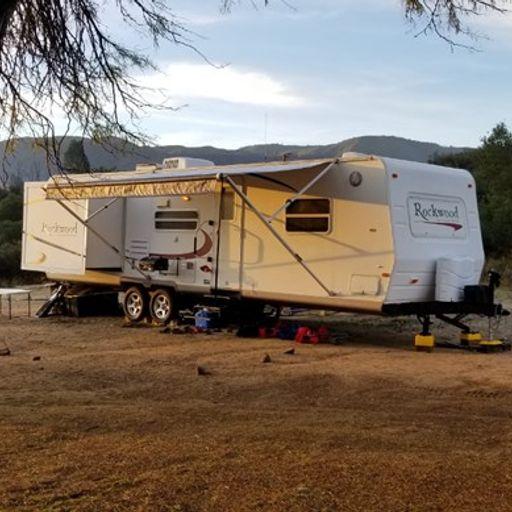
With 4 connecting trail options, including Dripping Springs [http://www.fs.usda.gov/recarea/cleveland/recarea/?recid=47536], Wildhorse [http://www.fs.usda.gov/recarea/cleveland/recarea/?recid=47584], Palomar Magee [http://www.fs.usda.gov/recarea/cleveland/recreation/recarea/?recid=47574&actid=104], and Cutca [http://www.fs.usda.gov/recarea/cleveland/recarea/?recid=47532], great views of the "Big Four" peaks to the north (Santiago Peak, Mt. Baldy, San Gorgonio, and San Jacinto) as well as wide ranging views of Vail lake, Temecula Valley and open countryside, Dripping Springs provides many great options for the recreational day user. Those looking for overnight camping accomodations after a long day on the trails can cozy up under the stars at the Dripping Springs Campground [http://www.fs.usda.gov/recarea/cleveland/recreation/camping-cabins/recarea/?recid=47534&actid=29].
Since these trails typically offer little shade, it is not recommended for the summer months, as temperatures typically hit triple digits. Fall and Spring bring colorful foliage and lovely wildflowers (after the rain) and are considered the best times of the year. Much of the area receives light use, which provides a pleasant and tranquil outdoor experience.
Places nearby:
The pursuit is happiness.
Sekr connects travelers to the campsites, community and journey they are seeking.
The pursuit is happiness.
Sekr connects travelers to the campsites, community and journey they are seeking.


