


Beartooth RD
Address: Luther, Montana
Cost: Free
About
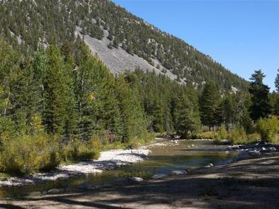
The Beartooth Ranger District is located in south central Montana and encompasses the Beartooth and Pryor Mountain Ranges. The district office is located in Red Lodge, MT, 65 miles southwest of Montana’s largest city, Billings. The district is known for its rugged mountains and sub-alpine tundra plateaus. The highest 41 peaks in Montana are located in the Beartooth Ranger District, including Granite Peak, which is the highest and stands at 12,799ft.
The district serves as the northeastern gateway to Yellowstone National Park and is home to the Beartooth Scenic Highway [https://www.fs.usda.gov/recarea/custergallatin/recarea/?recid=81370]. The Beartooth Highway is consistently rated one of the most scenic mountain drives in America. The highway, open from Memorial Day to mid-October (weather permitting), climbs to 10,947ft and offers stunning vistas and many recreation opportunities on the Custer Gallatin National Forest and the Shoshone National Forest [http://www.fs.usda.gov/shoshone].
The Absaroka-Beartooth Wilderness [https://www.fs.usda.gov/detail/custergallatin/specialplaces/?cid=stelprd3825895] makes up 65% of the Beartooth Unit and offers a wide range of scenic landscapes and hidden treasures. There are many trails that provide access to the Absaroka-Beartooth Wilderness, but be aware that travelling in the wilderness area comes with additional regulations [http://www.fs.usda.gov/Internet/FSE_DOCUMENTS/stelprd3831691.pdf].
For more information on the Beartooth Mountains, click here [http://www.fs.usda.gov/detail/custergallatin/?cid=STELPRD3830236].
__________________________
The Pryor Mountain Unit of the district is located about 60 miles east of Red Lodge, MT adjacent to both the Crow Indian Reservation [http://tribalnations.mt.gov/crow], BLM lands, and the Bighorn Canyon National Recreation Area [http://www.nps.gov/bica/index.htm]. The dry limestone uplifts and formations create a stark contrast to the Beartooth Mountains. The views from the Pryor Mountains offer long, beautiful vistas of the surrounding countryside. The peak time for wildflowers is the month of July.
Some of the highlights of the Pryor Mountain Unit are Big Ice Cave, Dry Head Vista, and the Pryor Mountain Wild Horse Range. The Pryor Mountain Wild Horse Range [http://www.blm.gov/mt/st/en/fo/billings_field_office/wildhorses.html] is found on the eastern edge of the Pryor Mountains and is managed by the BLM.
For more information on the Pryor Mountains, click here [http://www.fs.usda.gov/detail/custergallatin/?cid=STELPRD3830238].
___________________________
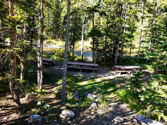
Recreation Opportunities on the Beartooth Ranger District are divided into four geographic locations:
* Beartooth Front [https://www.fs.usda.gov/recarea/custergallatin/recarea/?recid=81249] (Red Lodge Creek, East Rosebud, West Rosebud, Benbow, Stillwater River area)
* Meyers Creek Area [https://www.fs.usda.gov/recarea/custergallatin/recarea/?recid=81250]
* Pryor Mountains [https://www.fs.usda.gov/recarea/custergallatin/recarea/?recid=81251]
* Red Lodge Area [https://www.fs.usda.gov/recarea/custergallatin/recarea/?recid=81248] (US Hwy 212, West Fork of Rock Creek, Line Creek Area)
Maps:
Click here [http://www.fs.usda.gov/detail/custergallatin/?cid=STELPRD3830335] to see trail and area maps.
Important links:
* Know before you go [http://www.fs.usda.gov/detail/custergallatin/?cid=STELPRD3830242] (helpful travel information, weather, road conditions, forest fire information).
Places nearby:

The pursuit is happiness.
Sekr connects travelers to the campsites, community and journey they are seeking.
The pursuit is happiness.
Sekr connects travelers to the campsites, community and journey they are seeking.


