


West Tumamait Trailhead - 21W03
Cost: Free
About
Tumamait Trail (21W03)
Difficulty: moderate to difficult
Length: 4.58 miles
CHUMASH WILDERNESS - More information on the Chumash Wilderness: www.wilderness.net [http://www.wilderness.net/NWPS/wildView?wid=544]
Maps: 7.5 minute USGS topographic maps (Sawmill Mountain)
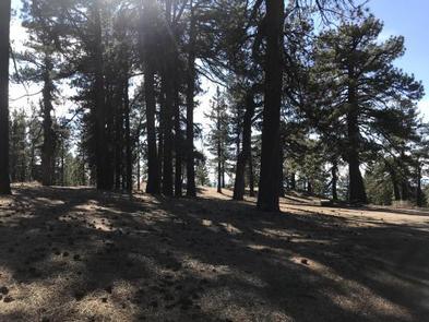
The West Tumamait Trailhead (elev. 8080 ft.) is located along Cerro Noroeste Road near the summit of Cerro Noroeste east of Camp Alto Campground. Trailhead parking is along the shoulder of the road. There are no facilities at the trailhead and overnight camping is not allowed. Campo Alto Campground, with 19 individual sites, is located 0.5 miles away at the end of Cerro Noroeste Road. The Mesa Springs Trail 22W21 and Northfork Trail 22W02 may be accessed via the Tumamait Trail.
Places nearby:
The pursuit is happiness.
Sekr connects travelers to the campsites, community and journey they are seeking.
The pursuit is happiness.
Sekr connects travelers to the campsites, community and journey they are seeking.


