


Buck Creek Trailhead- 18W01
Address: Maricopa, California
Cost: Free
About
Buck Creek Trail (18W01)
Difficulty: moderate to difficult
Length: 11.25 miles
SESPE WILDERNESS - More information on the Sespe Wilderness: www.wilderness.net
Maps: 7.5 minute USGS topographic maps (Black Mountain)
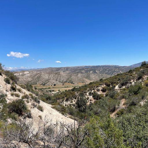
The Buck Creek Trailhead (elev. 3060 ft.) is located at the southern end of Hardluck Campground (which is currently Closed) and Forest Service Rd. 8N24. Trailhead parking is located 3.0 miles away at the locked gate off of Los Alamos Road, located adjacent to the southern portion of Hungry Valley State Vehicular Recreation Area. There are no facilities at the parking area or trailhead.
Places nearby:
The pursuit is happiness.
Sekr connects travelers to the campsites, community and journey they are seeking.
The pursuit is happiness.
Sekr connects travelers to the campsites, community and journey they are seeking.


