


East Marvine #1822
Address: Meeker, Colorado
Cost: Free
About
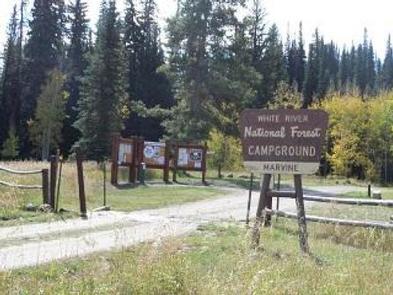
The East Marvine Trail begins on the left side of the corrals near the parking area adjacent to East Marvine Campground [https://www.fs.usda.gov/recarea/whiteriver/recarea/?recid=40775]. It crosses East Marvine Creek, then follows it upstream .5 miles to the Flat Tops Wilderness [http://www.fs.usda.gov/recarea/whiteriver/recarea/?recid=81112] boundary. The trail meets Johnson Lake 1.5 miles after the Wilderness boundary; it then crosses numerous small streams and winds its way another 2 miles to Rainbow Lake. Approximately 1 mile above Rainbow Lake, the trail leaves Marvine Creek and climbs 2 miles to the Flat Tops Plateau. During the climb, the trail crosses several rockslide areas as it switchbacks to the top. On top, the trail crosses the rolling tundra between Big Marvine Peak and Little Marvine Peak for 3 miles to Oyster Lake Trail #1825 [https://www.fs.usda.gov/recarea/whiteriver/recarea/?recid=40807].
Places nearby:
The pursuit is happiness.
Sekr connects travelers to the campsites, community and journey they are seeking.
The pursuit is happiness.
Sekr connects travelers to the campsites, community and journey they are seeking.


