


Mt. Baker Summit - Climbing
Address: Deming, Washington
Cost: Free
About
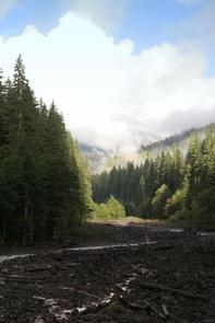
The most prominent feature of the Mt. Baker Wilderness is the 10,781 foot [3,286 meters] active volcano from which the wilderness takes its name. Mt. Baker is the northernmost volcano in the United States Cascade Range located 15 miles south of the Canadian border. The mountain is perpetually snow-capped and mantled with an extensive network of creeping glaciers. Baker's summit, called Grant Peak, is actually a 1,300-foot-deep mound of ice, which hides a massive volcanic crater. Directly to the south is a smaller and younger crater, which is currently a center of periodic steam eruptions. Sherman Crater is only partially ice-filled and the rim's pinnacle, known as Sherman Peak, reaches an elevation of approximately 10,160 feet [3,097 meters].
Mt. Baker lies in two separate congressionally designated areas: the Mt. Baker Wilderness [http://www.fs.usda.gov/recarea/mbs/recarea/?recid=79421] and the Mt. Baker National Recreation Area. [http://www.fs.usda.gov/recarea/mbs/recarea/?recid=30330] Most of Mt. Baker is in Wilderness, with the National Recreation Area encompassing the south slope.
Climbing Mt. Baker
* Mt. Baker offers a variety of approaches with varying degrees of technical difficulty for would-be climbers. Some of the more popular routes are via the Coleman Glacier and the Easton Glacier. All routes to the summit [http://www.fs.usda.gov/recarea/mbs/recarea/?recid=30317#routes] of Mt. Baker are technical climbs on glaciers. Glacier travel experience, knowledge of crevasse rescue techniques and safe climbing habits are a must.
* Guide services [http://www.fs.usda.gov/detail/mbs/?cid=stelprdb5176670] offer a variety of climbing courses and provide an opportunity to acquire and improve mountaineering skills.
Safety
* Review climbing safety information [http://www.fs.usda.gov/generalinfo/mbs/recreation/generalinfo/?groupid=32841&recid=30317]. Before climbing, leave your plans with someone you trust. Include your expected time of return, vehicle and license number, where you will park and your climbing route.
Voluntary Climbing Register
* The Forest Service does not require permits for climbing Mt. Baker. It is strongly advised that all climbing parties register for their own protection. Registration is optional. It will, however, provide valuable information in case of emergency. Download the form (pdf [http://www.fs.usda.gov/Internet/FSE_DOCUMENTS/stelprdb5422906.pdf]) (doc [http://www.fs.usda.gov/Internet/FSE_DOCUMENTS/stelprdb5139294.docx]) or pick one up at the ranger station [http://www.fs.usda.gov/detail/mbs/about-forest/offices]. Then submit your completed form at the ranger station before attempting the climb. When your party returns, sign out at the station or call and let them know of your safe return. Failure to sign out may result in a needless and costly search effort.
Regulations
* The Mt. Baker Wilderness and National Recreation Area maintain unique restrictions [http://www.fs.usda.gov/recarea/mbs/recarea/?recid=30317#climbregs] for hikers and climbers listed below.
* Review important sanitation information. [http://www.fs.usda.gov/detailfull/mbs/specialplaces/?cid=stelprdb5139441&width=full]
* Practice Leave No Trace [http://www.fs.usda.gov/detailfull/mbs/?cid=FSBDEV7_001580&width=full] methods.
Places nearby:

The pursuit is happiness.
Sekr connects travelers to the campsites, community and journey they are seeking.
The pursuit is happiness.
Sekr connects travelers to the campsites, community and journey they are seeking.


